The geological features present in our surroundings serve as tangible records of Earth’s tectonic past. The Earth’s narrative unfolds through processes like continental disintegration accompanying oceanic expanses and continental convergence culminating in the birth of towering mountain chains. These episodes mark distinct phases of the Earth’s tectonic saga. However, the question arises: How do we, with precision, peer into bygone epochs?
For billions of years, a significant and unceasing geological phenomenon has been shaping the Earth’s surface: sedimentation. This ongoing process involves the gradual buildup of a diverse array of sedimentary particles, varying greatly in size and composition, often derived from the erosion of rocks or the evaporation of liquids. This phenomenon transcends geographical boundaries, manifesting itself in diverse locales worldwide, be it the ocean depths, the courses of rivers, the shores of beaches, and beyond. Whenever these particles find their resting place and amass, the process of sedimentation unfurls, irrespective of whether they are ferried by the kinetic force of water currents or the gentle sweep of winds, and whether these particles manifest as minuscule grains of sand, resilient pebbles, or the remnants of aquatic life in the form of shells.
Sediments: Archives of the Past
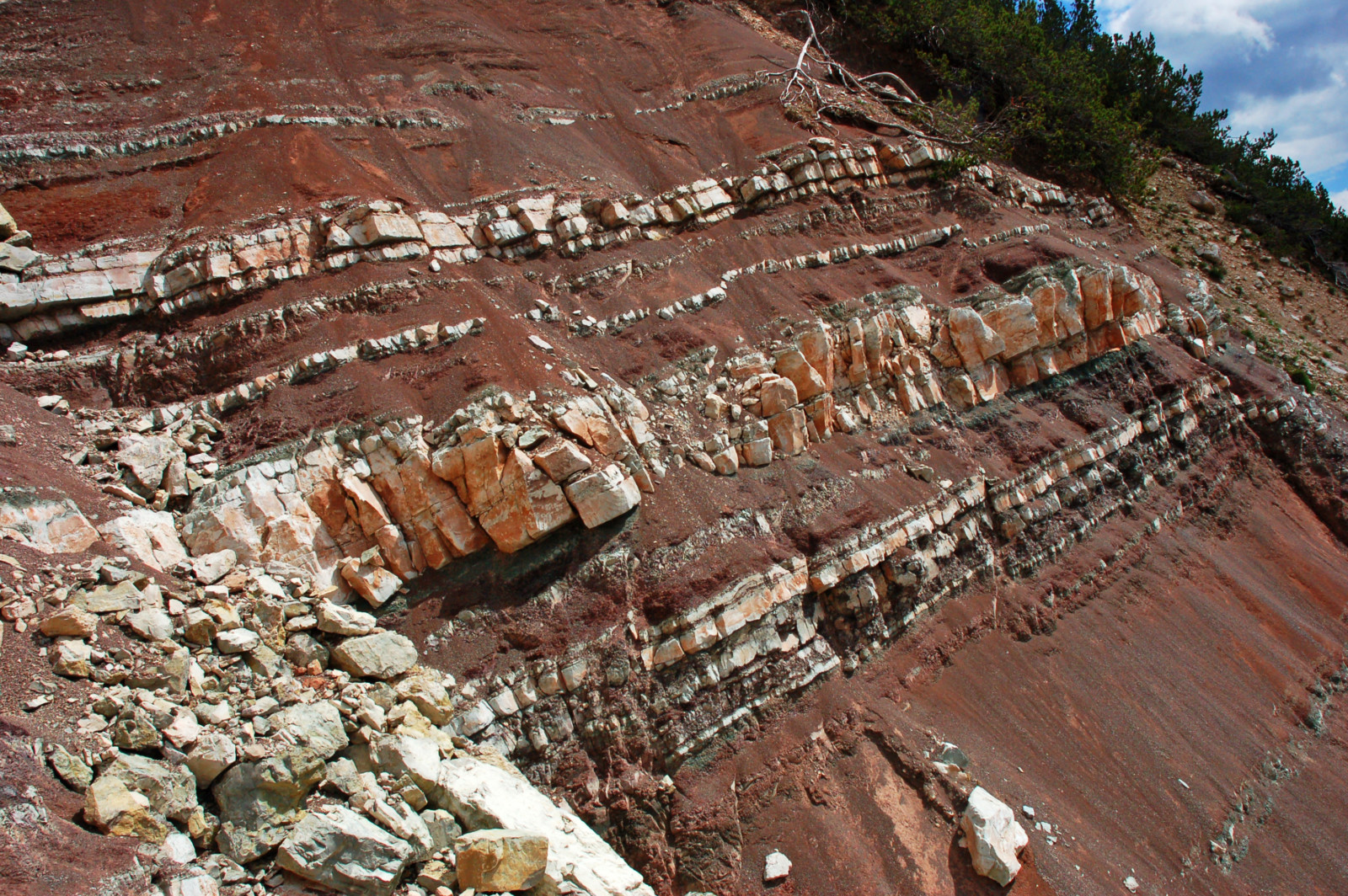
The process of sediment deposition follows a distinct trajectory: particles gather within basins, which are lower regions in terms of topography, and arrange themselves in a flat and horizontal manner, forming sequential layers known as sedimentary strata. Each distinct stratum is characterized by changes in deposition conditions: shifts in the environment like variations in depth or temperature, alterations in sediment source, fluctuations in particle size, and similar factors.
Over time, these layers undergo compaction, and unless there are disturbances in the depositional system, this process continues at a variable pace until the sedimentary basin reaches full capacity. This phenomenon can result in the accumulation of several kilometers of sedimentary material. There may have been millions of years separating the foundational strata at the basin’s bottom from the outermost sedimentary layers. As a result, the process of sedimentation offers a record of Earth’s history. Consequently, these strata harbor the potential to chronicle countless incidents that possess the capacity to disrupt their linear arrangement or the overall deposition milieu.
How Are Tectonic Events Recorded in Sediments?
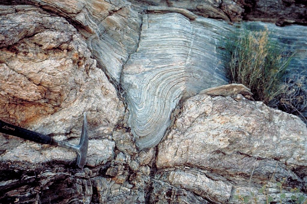
Tectonic occurrences, with a distinct emphasis on their capacity to reshape sedimentary accumulations, wield the power to amend the very framework of these deposits. Tectonic movements can take various forms: compressional or extensional, uplift or subsidence. These dynamic motions culminate in alterations of stress distributions within the geological formations, encompassing the sediments that were laid down earlier, thereby initiating distortions within the strata. This process elucidates the origin of phenomena like folding or the displacements evidenced by the emergence of faults.
How Do You Observe a Tectonic Event in Sediments?
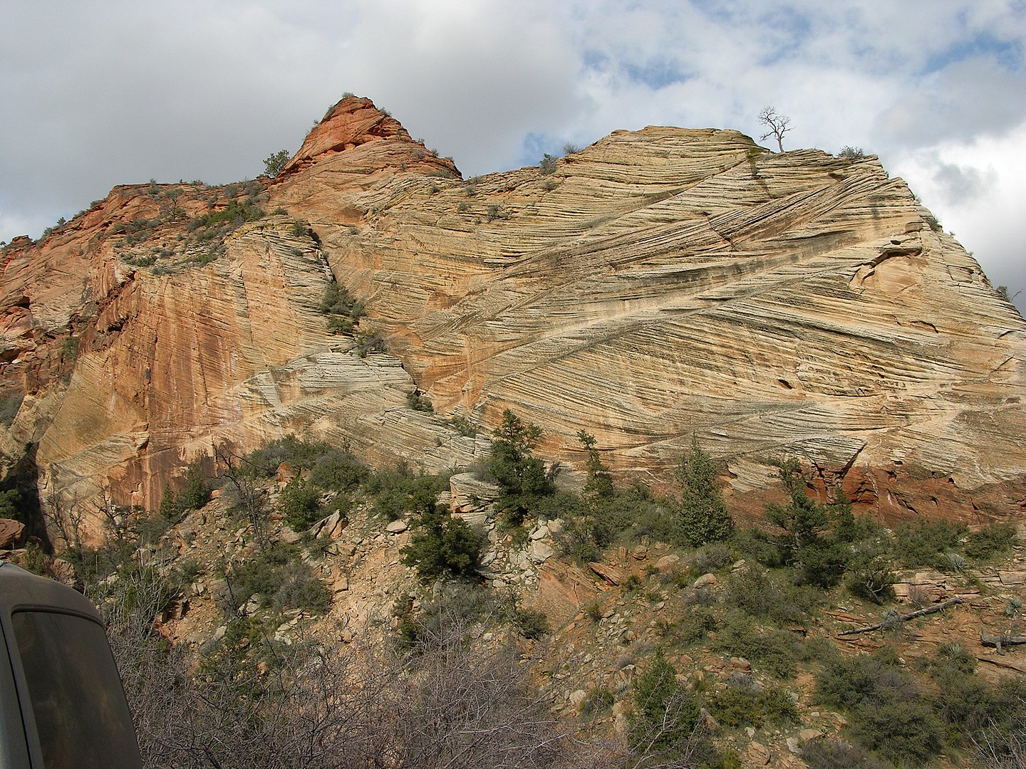
To perceive distortions within sedimentary strata, attaining access stands as an imperative requirement. Sedimentary archives can be accessed primarily through two distinct avenues: the direct geological examination of an outcrop and the scrutiny of seismic profiles (an indirect modality). For direct investigation, sedimentary strata that had been previously ensconced must undergo an exhumation process brought about by tectonic energies or erosional dynamics, culminating in their exposure. This phenomenon is witnessed, for instance, amid the convergence of continental landmasses and the genesis of mountain ranges. During these junctures, sediments that were once ensconced on the oceanic bed or within foreland basins can undergo transport over extensive distances, ultimately manifesting atop mountain summits, ripe for contemporary study.
The virtue of direct observation lies in its capacity to furnish a genuine portrayal of sediment geometry, stratum thickness, and compositional makeup. The analysis can delve into minute intricacies, yielding a nuanced depiction. However, a drawback materializes: the exposure phase can subject sedimentary rock formations to novel tectonic contortions and lithological modifications, including metamorphism, which progressively overlay one another. Consequently, if the focus of study resides in a tectonic episode predating a continental collision, disentangling the sequence of tectonic occurrences that subsequently distorted the sedimentary layers might pose challenges, though not insurmountable ones.
Conversely, the examination of seismic profiles extends access to the in-situ arrangement of sedimentary constructs. This methodological approach facilitates the imaging of sedimentary strata that remain concealed and undisturbed, potentially affording insight into primary deformations. Nevertheless, this avenue bears a drawback: it assumes an indirect character, and the insights gleaned hinge significantly on acquisition parameters. Furthermore, it lacks the ability to offer insights into rock composition, among other inherent limitations.
Presented below are several prevailing strategies employed in investigating tectonic occurrences etched into sedimentary accumulations:
Geological mapping: Geoscientists embark on field expeditions to meticulously map sedimentary strata and their accompanying distortions. This practice facilitates the visual identification of tectonic features such as folds, faults, and analogous structures.
Stratigraphic analysis: Delving into intricate analyses of distinct sedimentary layers unveils abrupt alterations in their alignment, thickness, or grain dimensions, serving as telltale signs of tectonic deformations.
Radiometric dating: Through the utilization of radiometric dating methodologies, researchers ascertain the ages of discrete sedimentary strata. This invaluable data contributes to reconstructing the chronological sequence of tectonic incidents.
Paleomagnetic studies: The deposition of sediments chronicles fluctuations in Earth’s magnetic field. Scrutiny of the magnetic orientations preserved within strata offers insights into bygone tectonic displacements.
Geological modeling: Scholars harness geological models to simulate the dynamics of tectonic processes and their ramifications on sedimentary accretions. These simulations provide profound comprehension of how tectonic distortions disseminate through sedimentary strata.
Analysis of fossils and microfossils: Specific fossils and microfossils exhibit sensitivity to environmental alterations linked with tectonic perturbations. Patterns in their distribution and assemblage offer pivotal clues concerning earlier deformations.
Geophysical studies: Geophysical techniques encompassing seismic reflection, gravimetry, and geodesy allow for the visualization of concealed tectonic structures beneath the terrestrial surface, consequently evaluating their influence on sedimentary layers.
Through the amalgamation of these diverse methodologies, scientists undertake the intricate task of piecing together the annals of ancient tectonic upheavals, thereby gaining profound insights into how these occurrences have shaped and altered the genesis of sedimentary accumulations.
Dating of Tectonic Events
Upon completing observations and identifying tectonically-induced distortions, the prospect of ascertaining the temporal occurrence of diverse events comes into play. This chronology can be established through absolute dating methodologies, encompassing techniques like carbon-14 dating and uranium/thorium dating, or by leveraging the presence of fossils. Alternatively, a relative approach can be undertaken, whereby the succession of tectonic incidents unfolds by closely scrutinizing the spatial arrangement and geometrical attributes of the strata in relation to one another.
For instance, consider the scenario where each fault event is deconstructed: this entails defining the pre-tectonic sediments (deposited antecedently to the fault’s emergence), the syn-tectonic sediments (deposited during the fault’s developmental phase), and the post-tectonic sediments (deposited following the fault’s formation). In this framework, the fault is conspicuously evident within the pre-tectonic sediments, while the syn-tectonic sediments exhibit intricate configurations reminiscent of fan-like shapes. Subsequently, the post-tectonic sediments encapsulate the fault, preserving its form without alteration.
References
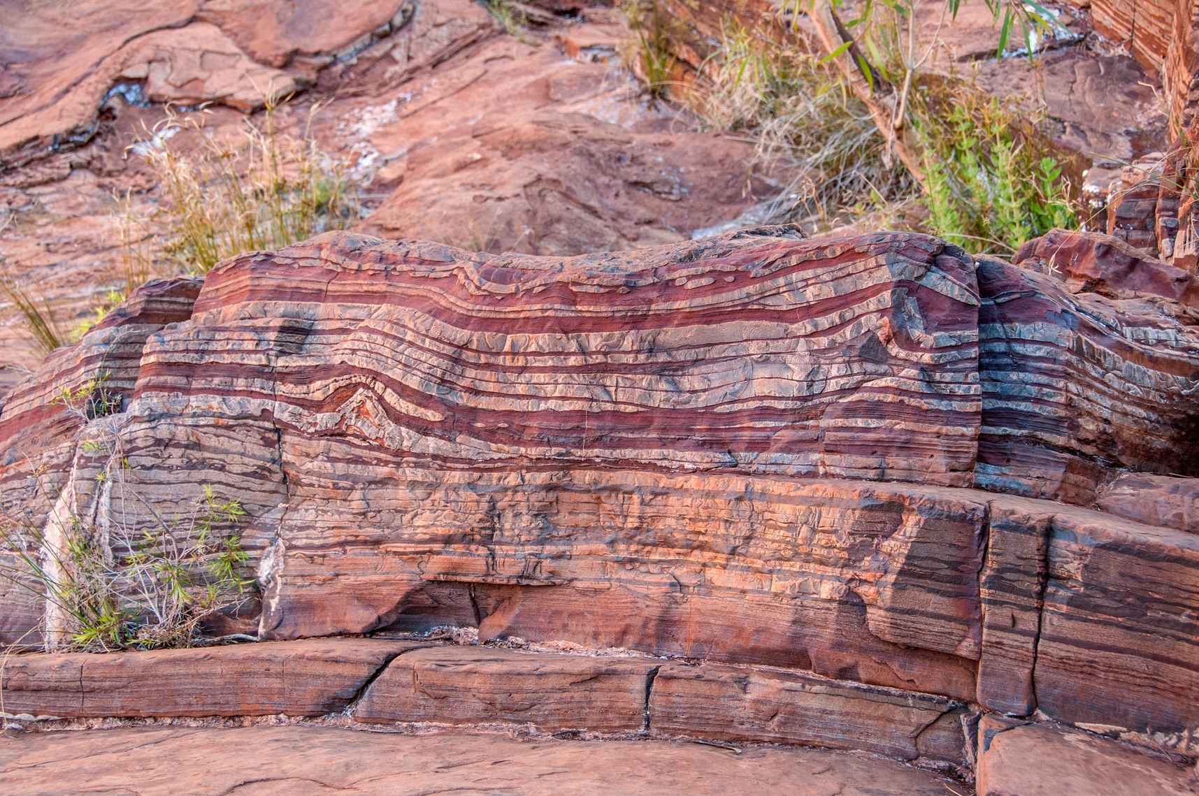
- Featured Image: Banded iron formation, Karijini National Park, Western Australia,Dales Gorge, CC BY 2.0