Numerous variables such as local topography, proximity to bodies of water, latitude, average temperatures and wind patterns affect the amount of rainfall that occurs in various parts of the world. In some cities, more than 100 mm of rainfall over a single weekend can have significant consequences, including interruptions in the electricity supply to thousands of homes, canceled landings of jetliners and stranded motorists in their vehicles. However, compared to the regions that receive the most rainfall globally, these rain-induced disasters can be considered relatively small-scale.
Key Takeaways: The Wettest Regions on Earth
- Located in the state of Meghalaya, Mawsynram holds the Guinness World Record for the highest average annual rainfall. It receives an average of over 11,871 millimeters (467 inches) of rainfall each year.
- Also in Meghalaya, Cherrapunji was once considered the wettest place on Earth. It receives an average of around 11,777 mm (463.7 in) of rainfall annually.
- Situated in the Chocó Department of Colombia, Tutunendo is known for its extremely high precipitation, receiving an average of over 11,770 millimeters (464 inches) of rainfall each year.
In regions with extreme amounts of rainfall, the impact can be far more significant and challenging to manage. These places often have unique weather patterns and climatic conditions that lead to exceptionally high precipitation. The excessive rainfall can result in extensive flooding, landslides, and severe damage to infrastructure, agriculture, and human settlements. Some regions, particularly those near the equator and tropical areas, experience heavy monsoons or relentless tropical cyclones that bring prolonged periods of heavy rain and devastating consequences.
Examples of places that receive the highest rainfall in the world include regions in India’s northeastern states like Mawsynram and Cherrapunji, where rainfall is recorded in meters rather than millimeters annually. These areas are known for their lush green landscapes and stunning waterfalls, but they also face significant challenges in managing the effects of such relentless rainfall.
While a city experiencing more than 100 mm of rain in a weekend may be considered an inconvenience, it is essential to recognize that there are places in the world where rainfall can have much more profound and life-altering impacts. Understanding and managing the diverse effects of rainfall across different regions are crucial for building resilient communities and infrastructure in the face of changing weather patterns and climate challenges.
Mount Emei, Sichuan Province, China
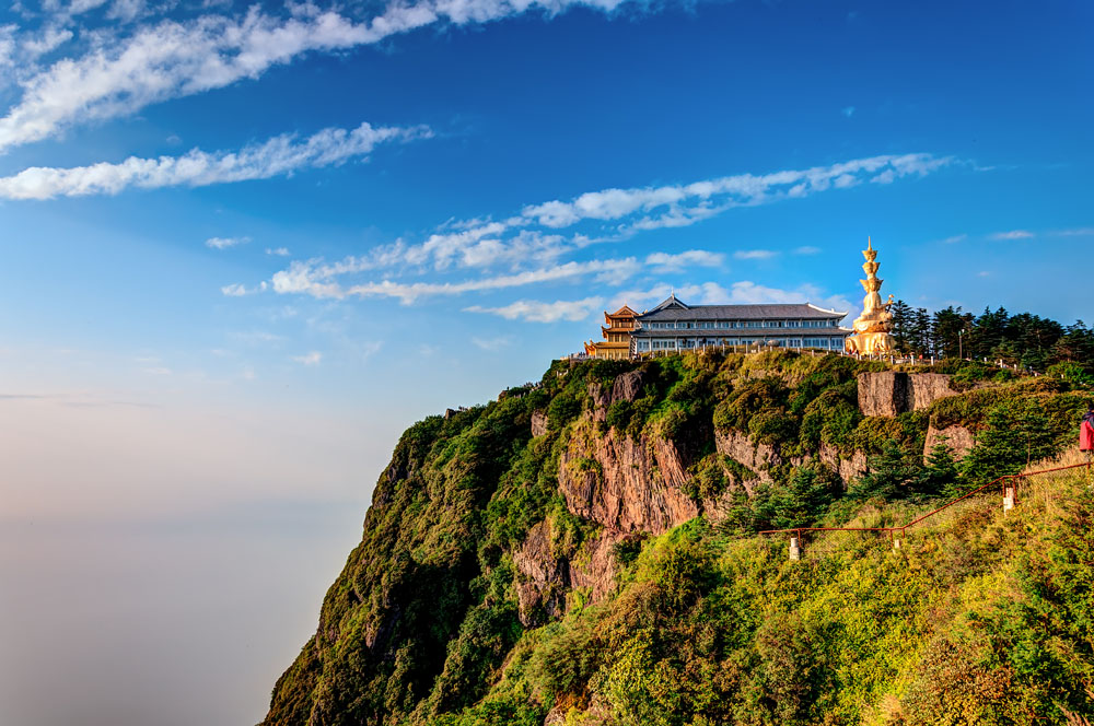
Average annual rainfall: 8,169 mm (321.6 in).
Emei Mountain holds a significant place among the Four Sacred Mountains of Buddhism and is renowned as the wettest location in China. The region experiences a mesmerizing natural phenomenon known as the “sea of clouds.” This breathtaking spectacle occurs when double-layered clouds are present, typically during the monsoon season, which brings substantial amounts of rainfall to the area.
The combination of high elevation and climatic conditions during the monsoon season results in the formation of these captivating double-layered clouds. As the moist air rises and cools at higher altitudes, it condenses into clouds, creating a lower layer. Above this layer, another layer of clouds can form due to varying atmospheric conditions, resulting in a mesmerizing sight resembling an expansive “sea of clouds.”
The “sea of clouds” phenomenon adds to the natural allure and mystique of Emei Mountain, drawing visitors from all over the world to witness this breathtaking spectacle. The area’s lush vegetation, misty surroundings, and ancient temples further enhance the spiritual and serene ambiance of the mountain, making it a revered pilgrimage site for Buddhists and a sought-after destination for nature enthusiasts and travelers alike.
Puʻu Kukui, Maui, Hawaii
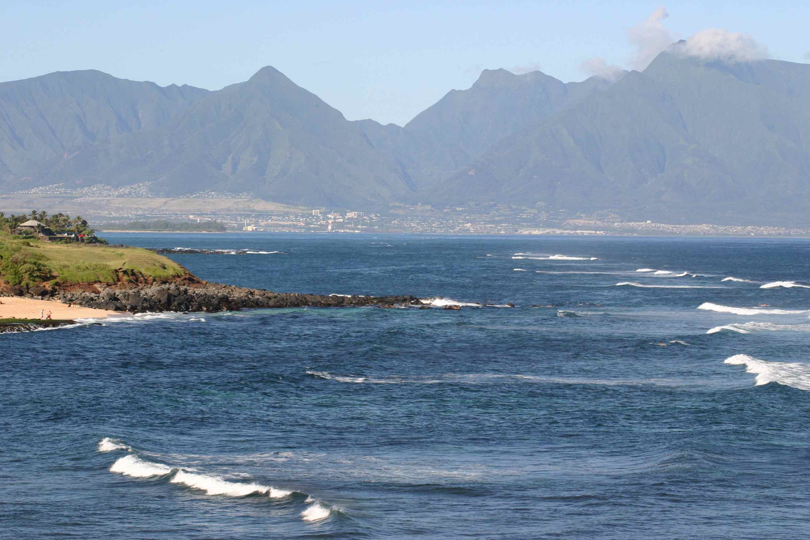
Average annual rainfall: 9,293 mm (365.9 in).
Mount Puʻu Kukui, situated on the beautiful island of Maui, is renowned as one of the rainiest places on Earth. Reaching an elevation of approximately 5,788-foot (1,764 m), this mountain experiences copious amounts of precipitation due to the influence of the prevailing northeast winds.
The unique geographic positioning of Mount Puʻu Kukui plays a significant role in its extraordinary rainfall. As the northeast trade winds blow moisture-laden air towards the mountain, the air rises and cools at higher altitudes. This process causes the moisture to condense, leading to the formation of clouds and heavy rainfall on the slopes of Mount Puʻu Kukui.
The combination of high elevation and the consistent flow of moist air results in an environment that receives a remarkable amount of rain throughout the year. The lush and vibrant vegetation found on the mountain is a testament to the abundance of rainfall, creating a haven for diverse plant and animal life.
The precipitation on Mount Puʻu Kukui sustains rich forests, gushing streams, and picturesque waterfalls, adding to the natural beauty and allure of Maui’s landscape. This exceptional rainfall pattern has shaped the island’s ecology and contributed to its reputation as a verdant paradise, attracting visitors from far and wide to experience the breathtaking scenery and diverse ecosystems of Mount Puʻu Kukui.
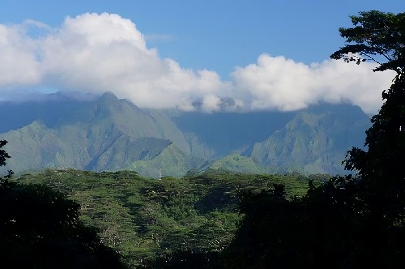
Mount Waialeale, Kauai, Hawaii
Average annual rainfall: 9,500 mm (373 in).
Waialeale Mountain is a volcano located on the island of Kauai, Hawaii, and it bears a name that means “overflowing water.” This mountain receives such heavy rainfall in its surroundings that it remains constantly wet and slippery, making access to its summit quite challenging.
Mount Puu Kukui, standing at an elevation of 5,148 feet (1,569 meters), is renowned for being one of the rainiest places on Earth. Since 1912, this mountain has averaged more than 373 inches (9,500 millimeters) of rain per year, with a record-setting 683 inches (17,300 millimeters) in 1982. Its summit has earned the distinction of being one of the wettest spots on the planet.
Despite its impressive rainfall statistics, recent reports have identified a new contender for the title of the wettest spot in Hawaii. Over the period from 1978 to 2007, the location that received the most rainfall in Hawaii was Big Bog on Maui, which recorded an astounding average of 404 inches (10,300 millimeters) of rain per year.
The distinction between Mount Puu Kukui and Big Bog demonstrates the variability of rainfall patterns in different locations on the islands of Hawaii. Both places experience considerable amounts of precipitation, contributing to the lush landscapes and abundant vegetation that characterize the region.
Big Bog, Maui, Hawaii
Average annual rainfall: 10,300 mm (404 in).
Despite being constantly exposed to heavy rains, Big Bog remains an important tourist destination in Maui due to its lush green scenery. The incredible rainfall is a result of the moisture from the eastern trade winds of the Pacific colliding with the steep mountain slopes.
The collision of these eastern trade winds with the mountain creates a surprising amount of rainfall, which contributes to the vibrant and abundant vegetation in Big Bog. Due to the stunning scenery and dense vegetation, this natural phenomenon draws tourists who are enamored with the area’s beauty. Despite the challenges posed by the continuous rainfall, the allure of Big Bog’s breathtaking scenery makes it a must-visit destination for those seeking to immerse themselves in Maui’s natural wonders.
According to claims, this location is reputed to be among the most precipitation-rich areas worldwide, boasting a recorded annual rainfall of 404 inches (10,300 mm) during the time span from 1992 to 2018.
Debundscha, Cameroon, Africa
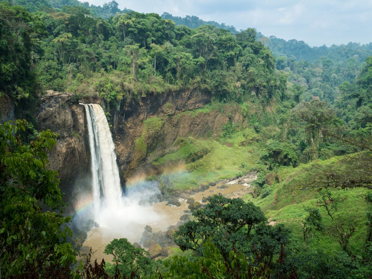
Average annual rainfall: 10,299 mm (405.5 in).
Debundscha village is located at the foothills of Mount Cameroon, Africa’s highest peak. The mountain’s obstruction of clouds significantly contributes to local rainfall, making Debundscha one of the rainiest places on Earth.
The summit of Mount Cameroon is often shrouded in dense clouds, carrying high levels of moisture. The easterly trade winds push this moist air from the Pacific Ocean towards the slopes of the mountain. As the air rises due to the mountain’s height, it cools and condenses, leading to the formation of heavy clouds. The condensation reaches its saturation point, resulting in abundant precipitation. This phenomenon causes Debundscha village to receive copious amounts of rain, making it one of the wettest places on the planet.
These intense rainfalls nourish the local vegetation and wildlife, while also providing crucial agricultural resources and water sources for the villagers. However, the excessive rainfall can sometimes lead to natural challenges such as floods and soil erosion. Nevertheless, Debundscha village continues to attract tourists’ attention due to its unique natural beauty and status as one of the world’s most rain-drenched regions.
Debundscha exhibits an exceedingly humid climate, characterized by an impressive annual precipitation of approximately 10,299 millimeters (405.5 inches).
San Antonio de Ureca, Bioko Island, Equatorial Guinea
Average annual rainfall: 10,450 mm (418 in).
San Antonio de Ureca proudly claims the title of Africa’s rainiest destination. Although a brief dry season extends from November to March, diminishing rainfall during this period, the majority of the year in this region witnesses substantial precipitation.
This profusion of rain enriches the landscape, nurturing diverse plant and animal life. Notably, a fascinating occurrence transpires during the brief dry spell: the nesting of turtles. Those who journey here during this interval can witness the captivating spectacle of turtles making their way ashore to lay eggs, adding to the area’s ecological significance.
The wet season in San Antonio de Ureca profoundly supports the local ecosystem, ensuring ample water for plant growth, wildlife, and agriculture. Nonetheless, it can also pose challenges such as flooding, underscoring the necessity for effective water management and infrastructure.
Collectively, the unique climatic patterns of San Antonio de Ureca forge an exceptional environment, drawing visitors and enhancing the region’s ecological diversity and natural allure.
Ureka is renowned globally for its extraordinary precipitation levels, with an annual rainfall tally of approximately 10,450 millimeters (418 inches). It secures its position as Africa’s most rain-drenched locality, an exceptional distinction on the continent.
Cropp River, New Zealand

Average annual rainfall: 11,516 mm (453 in).
The Cropp River, though spanning just 9 kilometers (6 mi), has achieved renown as one of the wettest places on the planet. The area where the river is situated receives an extraordinary volume of rain, cementing its reputation as a hub for rainfall.
Notably, this locale has witnessed some of the lengthiest recorded spells of uninterrupted rain. A standout example involves a staggering 48-hour downpour, underscoring the region’s capacity to accumulate and retain substantial rainfall over extended durations.
This consistent and abundant precipitation profoundly shapes the local ecosystem and surroundings. It fosters the growth of luxuriant vegetation, sustains wildlife, and exerts influence over the hydrological processes of the river and the adjacent landscape. The frequent occurrence of heavy rainfall contributes to the distinct attributes of the Cropp River and has likely captivated the attention of scientists and meteorologists who explore precipitation patterns.
The significance of the Cropp River’s rainfall surpasses its size, showcasing the remarkable potential of specific Earth regions to amass copious rain, rendering it a captivating and noteworthy natural spectacle.
On the 25th and 26th of March 2019, an unparalleled quantity of rainfall—measuring a staggering 1,086 millimeters (42.8 inches)—was documented in the Cropp River vicinity, setting an extraordinary milestone as the highest recorded precipitation in a 48-hour period within New Zealand.
Tutunendo, Colombia, South America
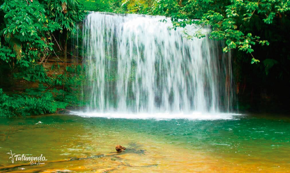
Average annual rainfall: 11,770 mm (463 in).
Tutunendo and Quibdo are actually the same region in Colombia, and Quibdo is known as one of the rainiest cities in the world, not just nearby the region. The Tutunendo region, being part of Quibdo, experiences a climate with two rainy seasons, resulting in almost constant rainfall throughout the year.
As mentioned earlier, Quibdo holds the prestigious title of being the rainiest city in the world. The area sees limited sunlight, with only three to four hours of sunshine per day on average. Even during the supposed driest months of the year, which are February and March, rainfall remains prevalent, with approximately 20 days of rain occurring in a typical month.
This continuous rainfall sustains a lush and thriving ecosystem in the region, supporting dense vegetation and rich biodiversity. It also presents challenges for the local communities, including potential water shortages during the dry season and issues related to pollution and drainage during heavy rainfalls.
Despite the challenges posed by the abundant rainfall, the Tutunendo (Quibdo) region’s natural beauty and unique weather patterns make it a fascinating and intriguing place to explore for travelers and weather enthusiasts seeking to experience one of the rainiest areas on the planet.
Cherrapunji, Meghalaya State, India
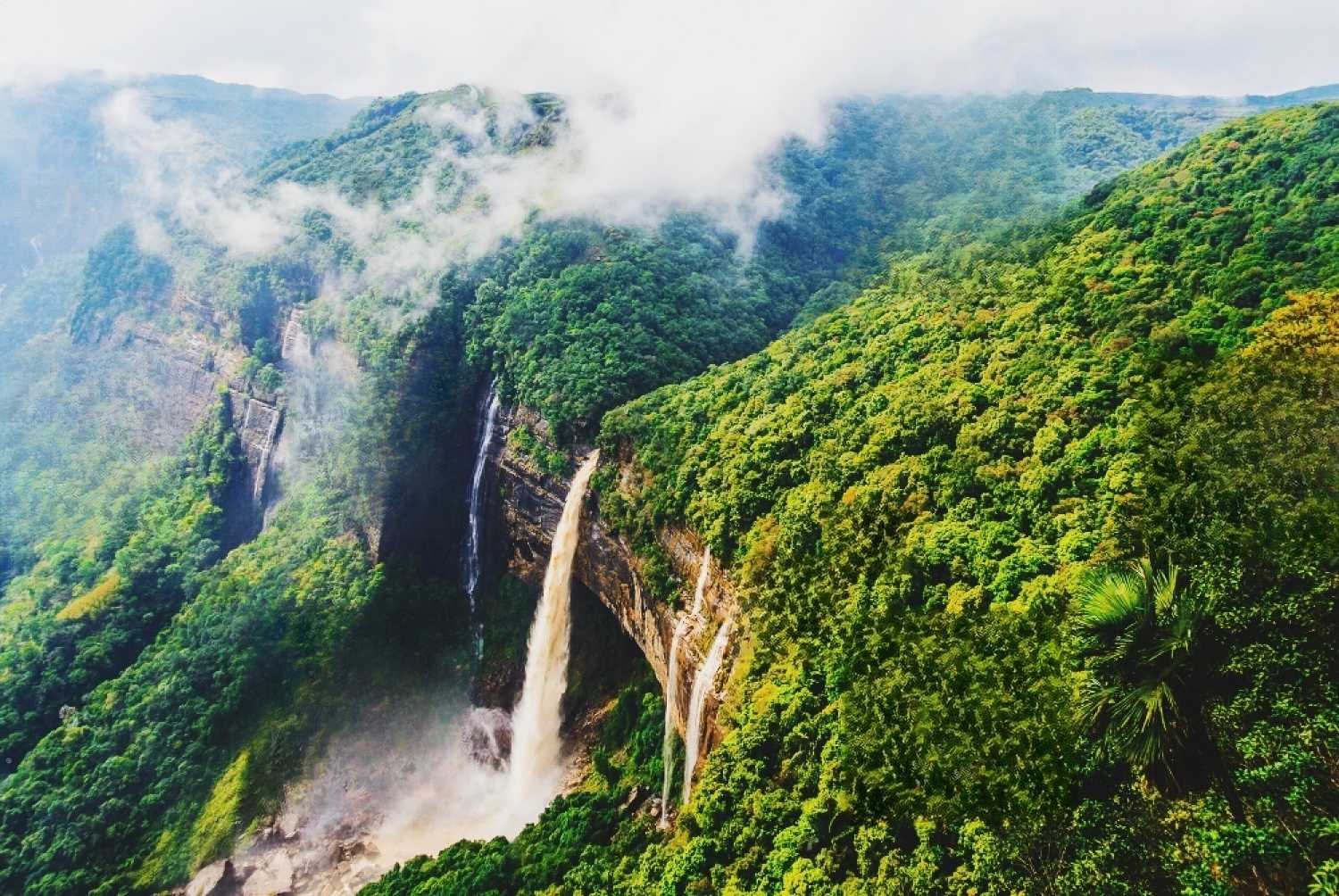
Average annual rainfall: 11,777 mm (463.7 in).
It is indeed ironic that Cherrapunji, despite being the second wettest place on Earth, faces water scarcity during the winter months when rainfall is scarce. The village’s reliance on rainwater as a primary water source makes it vulnerable to extended periods of drought during the dry season.
The continuous downpours during the rainy season also present challenges, as the region can experience pollution issues due to excessive runoff and overwhelmed drainage systems. These heavy rainfalls can persist for 15-21 days at times, causing various environmental and infrastructural concerns.
Sitting at an altitude of 1,370 meters, Cherrapunji enjoys a moderate climate, with average temperatures of 23 degrees Celsius during the summer and 7 degrees Celsius in the winter. The altitude contributes to the unique weather patterns and adds to the allure of the region.
Despite the challenges posed by the weather, Cherrapunji boasts breathtaking natural attractions, including mesmerizing waterfalls, picturesque hills, and fascinating living root bridges. These remarkable features have earned it a reputation as one of the most captivating places among the world’s rainiest spots.
The lush landscapes, rich biodiversity, and cultural heritage make Cherrapunji a popular destination for travelers and nature enthusiasts seeking to explore the beauty and diversity of one of the rainiest and most intriguing places on the planet.
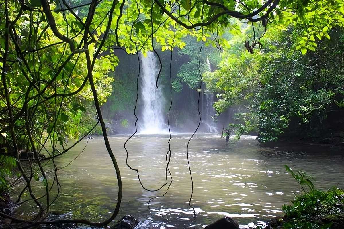
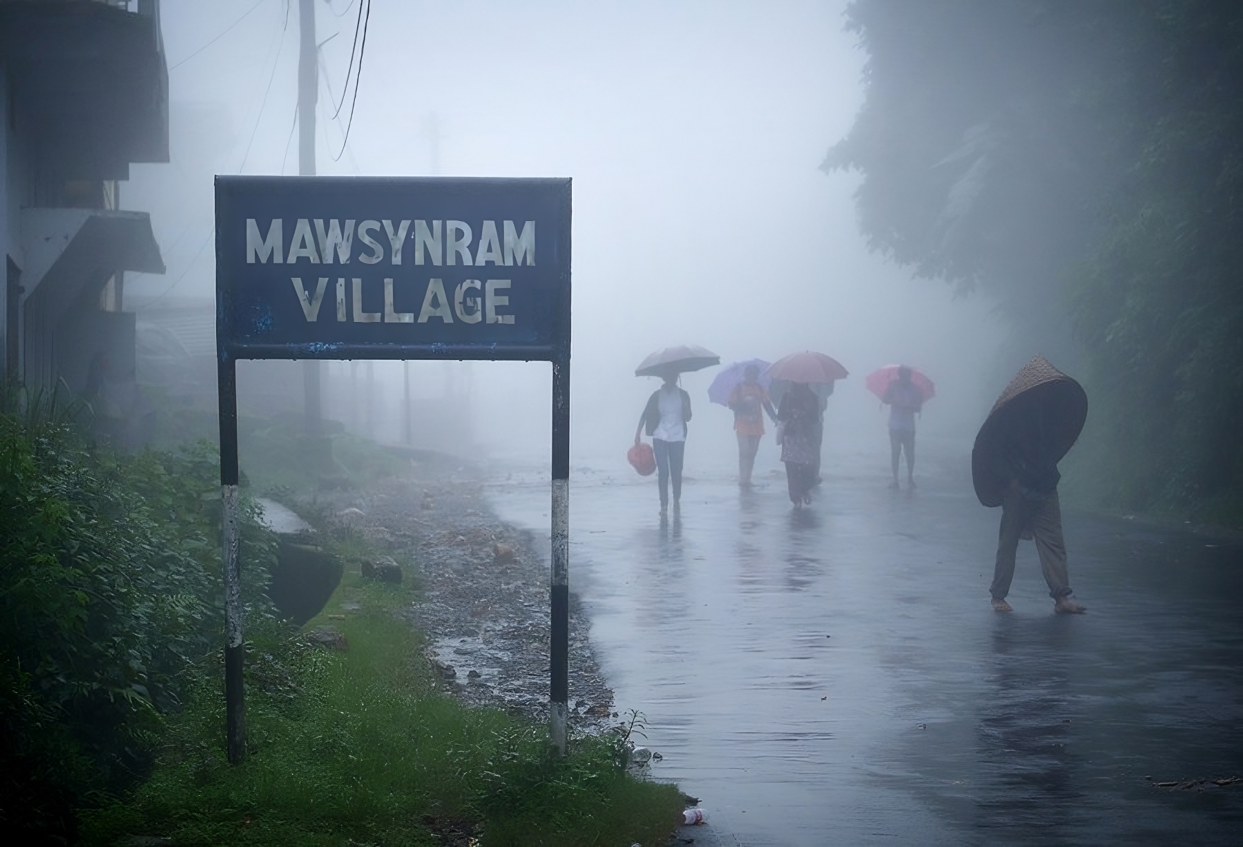
Mawsynram, Megalaya State, India
Average annual rainfall: 11,871 mm (467,4 in).
Mawsynram, located just 15 kilometers away from Cherrapunji, is a village that sparks debates over holding the title of the rainiest place on Earth. The incessant rainfall during the monsoon season poses challenges for the villagers, leading them to adopt unique ways to protect themselves from the deafening rain.
To shield themselves from the heavy downpours, the villagers in Mawsynram cover the roofs of their huts with grass. This traditional practice helps insulate their homes and provides some protection from the continuous rainfall. Additionally, the locals have developed the habit of never leaving their homes without umbrellas throughout the year, allowing them to be prepared for sudden showers.
Local farmers who work in the fields have devised a practical solution by using bundles of reeds to create basket-like hats. These hats serve as a form of rain protection while they work in the fields, allowing them to continue their agricultural activities despite the constant rainfall.
Meteorologists attribute Mawsynram’s abundant rainfall to its proximity to Bangladesh and the Bay of Bengal. Moisture accumulated over the Bay of Bengal contributes to heavy rainfall in the region, resulting in an intense and prolonged monsoon season. This geographical factor plays a significant role in the village’s remarkable precipitation levels.
The unique practices and adaptations of the villagers in Mawsynram showcase the resourcefulness and resilience of the local community in coping with the extreme weather conditions they face. Despite the challenges posed by the heavy rainfall, Mawsynram’s reputation as one of the rainiest places on Earth adds to its intrigue and fascination among travelers and weather enthusiasts alike.
The Wettest Regions on Earth
| Yer | Ülke ve bölge | Yıllık ort. yağış |
|---|---|---|
| Mawsynram | Megalaya State, India | 11,871 mm (467,4 in) |
| Cherrapunji | Megalaya State, India | 11,777 mm (463.7 in) |
| Tutunendo | Colombia, South America | 11,770 mm (463 in) |
| Cropp River | New Zealand | 11,516 mm (453 in) |
| San Antonio de Ureca | Bioko Island, Equatorial Guinea | 10,450 mm (418 ins) |
| Debundscha | Cameroon, Africa | 10,299 mm (405.5 in) |
| Big Bog | Maui, Hawaii | 10,300 mm (404 in) |
| Waialeale | Kauai, Hawaii | 9,500 mm (373 in) |
| Puʻu Kukui | Maui, Hawaii | 9,293 mm (365.9 in) |
| Emei Shan | Sichuan Province, China | 8,169 mm (321.6 in) |
This Article at a Glance
How does the Indian Ocean influence rainfall patterns in certain regions?
Which island in Hawaii is one of the wettest places in the world?
Which area in the United States is known for high rainfall?
What is the annual rainfall in Mawsynram?
Which place is considered the wettest on Earth?
References
- MT WAIALEALE 1047, HAWAII – Climate Summary (dri.edu)
- Burt, Christopher (15 May 2012). “New Wettest Location for U.S.A. Discovered?”. Wunderground. Weather Underground.
- Frankham, Richard; Ballou, Jonathan D.; Briscoe, David Anthony (2004). A primer of conservation genetics. Cambridge University Press. p. 180
- Richard Frankham, Jonathan D. Ballou, David Anthony Briscoe (2004). A primer of conservation genetics. Cambridge University Press.
- Weather & climate updates for #NewZealand and worldwide”. NIWA. 27 March 2019.
- “Cherrapunji, India: Climate, Global Warming, and Daylight Charts and Data”. climate-charts.com.